NATURAL RESOURCE FEATURES OF CHAUTAUQUA COUNTY
More than 50 percent of Chautauqua County is woodland; therefore, commercial timber production is a viable industry. Most of the natural standing timber is represented by mixed hardwoods dominated by Sugar Maple, Red Oak, Black Cherry, White Ash, and American Beech. Many wooded areas have been harvested several times for timber production.
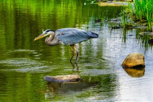
No location in Chautauqua County is more than 25 minutes from open water. The County contains the larger systems of Lake Erie and Chautauqua Lake, as well as Bear, Cassadaga, Findley, and Mud (East and West) Lakes.
Chautauqua Lake, at 1,308 feet above sea level, is one of the highest navigable waters in North America. Measuring 17.5 miles long and covering 13,156 acres, the lake produces fishing for Walleye, Bass, Muskellunge, and several Panfish species. The lake is divided into two basins: North and South. The north basin averages 25 feet in depth, with a maximum of 75 feet. The south basin is considerably shallower, with an average of 11 feet and a maximum of 19 feet.
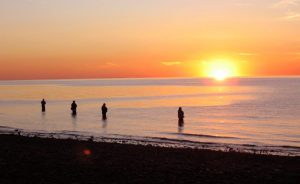
Lake Erie is the fourth largest of the Great Lakes in surface area and the smallest by volume. The Lake measures 241 miles long and has an average depth of 62 feet (maximum of 210 feet). Chautauqua County contains 1,065 square miles of Lake Erie shoreline. Lake Erie is the warmest and most biologically productive of the Great Lakes, and is known for its walleye fishing, widely considered the best in the world. (Pictured below.)
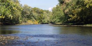
French Creek Watershed is designated as one of the “Last Great Places” by the Nature Conservancy includes the 90-acre French Creek Preserve. French Creek is the most biologically diverse ravine system in the Northeast and includes twelve globally rare species. (Pictured below.)